Asset Management
Supporting Local Urban Planning Processes in Tanzania
Challenge
To understand urban growth in secondary Tanzanian cities as the basis for strategic and sustainable urban planning.
Solutions Created By Us
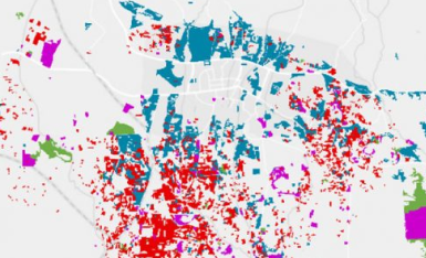
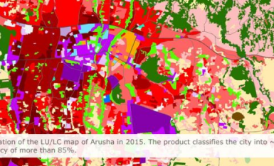
We created land use/land cover (LULC) maps showing 15 years of urban development in the Tanzanian cities of Arusha, Dodoma, and Kigoma, based on very high and high-resolution satellite data provided by EO4SD-Urban to the World Bank project -“Tanzania Strategic Cities Project”.
These maps assisted with the analysis of existing urban master plans, current developments, changes, and trends. The map layers included:
– Transport infrastructure
– Urban extent and green areas
– Population distribution and density
– Informal settlements
Customer Benefits
– LULC maps enable an analysis of city growth by visualizing the geographical changes over time
– Development trends affecting specific urban locations can be identified
– New city master plans can be created based on up-to-date urban spatial analysis